Moreton Bay
79 boat ramps, 2 gateways, 7 campsites, 4 dive sites, 1 hidden gem and 12 historic sites across 8 destinations.
Destinations
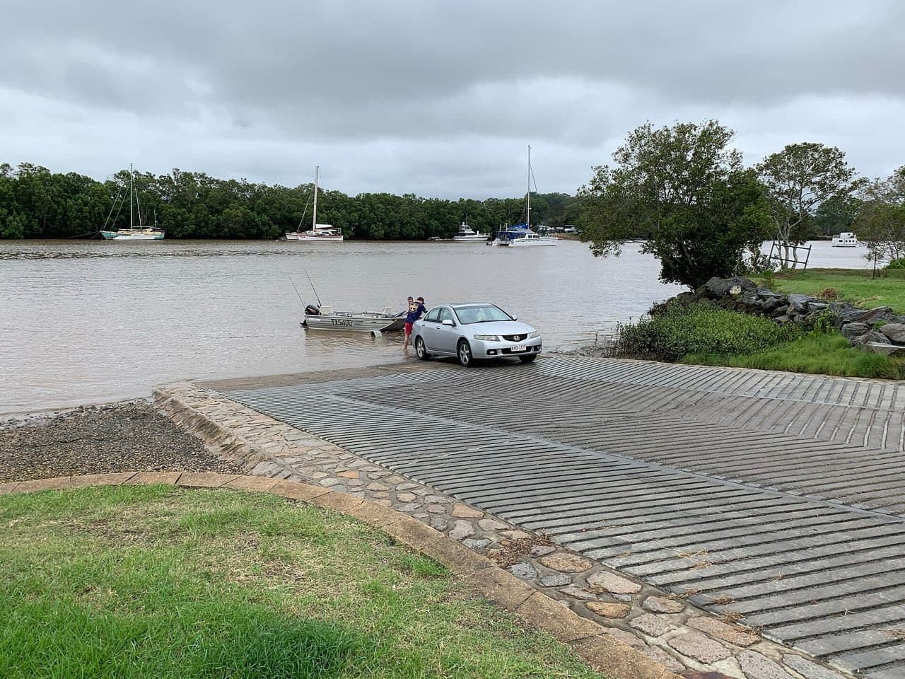
Moreton Bay mainland
67 boat ramps and 94 photographs

Moreton Island
1 gateway, 2 campsites, 2 dive sites, 6 historic sites and 73 photographs

Bribie Island
3 boat ramps, 3 campsites, 2 historic sites and 9 photographs
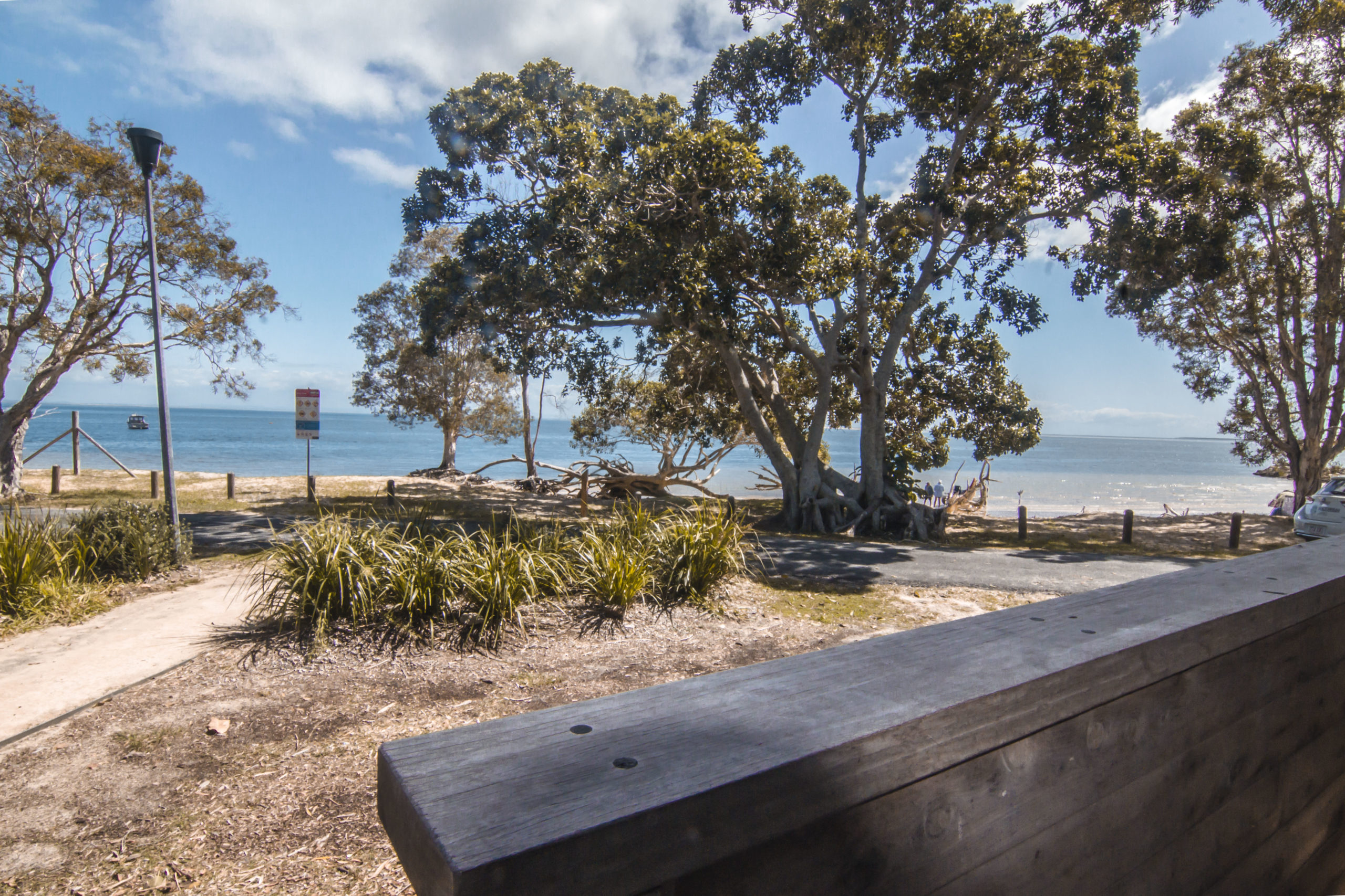
North Stradbroke Island
2 boat ramps, 2 campsites, 2 dive sites, 1 hidden gem, 1 historic site and 4 photographs

Southern Moreton Bay Islands
6 boat ramps
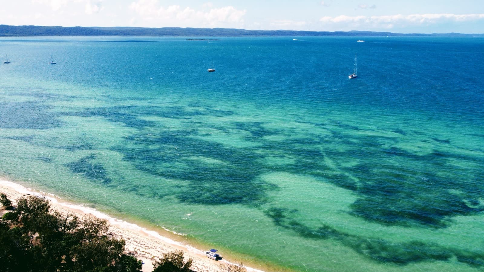
Peel Island
1 gateway, 2 historic sites and 42 photographs

St Helena Island
1 historic site
Coochiemudlo Island
1 boat ramp
Everything in Moreton Bay
Boat ramps
79Mainland
Alberton, Alberton Road
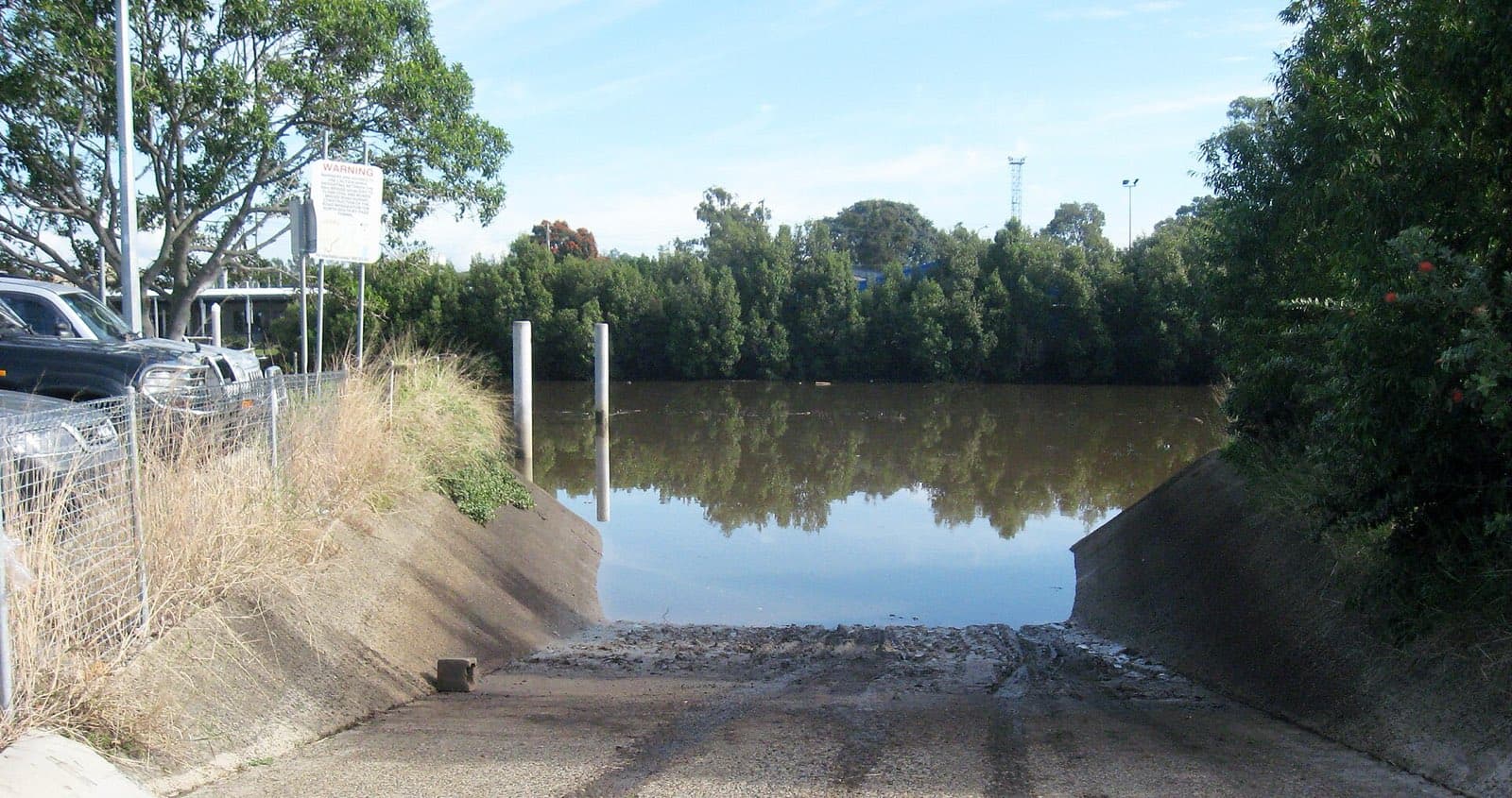
A wide single ramp with a floating pontoon on the south bank of the Logan River at Alberton – secluded, with toilets, water and 17 bays, and room to drive around with a big rig. The quiet way onto the lower Logan and the southern bay.
Mainland
Albion, Beaumont Street
The Breakfast Creek ramp at Albion – a single lane with a pontoon on the north bank of the creek near its mouth, a tap, seven bays, and the Brisbane River a few hundred metres away. Tide-limited in the creek.
North Stradbroke Island
Amity Point, Claytons Road
The Amity Point ramp on Claytons Road – two lanes with a pontoon and jetty beside Catarita Park, with toilets and picnic tables, unformed parking, and the Rainbow Channel tide running hard past the point.
Mainland
Bald Hills, Barungwarra Reserve
A single lane into the South Pine River at Barungwarra Bushland Reserve, Bald Hills – unmarked parking for about 16, no facilities, and an eight-tonne load limit. A quiet bushland launch on the upper Pine.

Mainland
Bald Hills, Wyampa Road
Deep Water Bend at Tinchi Tamba Wetlands Reserve, Bald Hills – two lanes with a pontoon and floating walkway on the Pine River, toilets, water, 55 bays, and picnic areas and a playground in the reserve. The main launch for the Pine and Bramble Bay.
Mainland
Beachmere, Saint Smith Road
Beachmere's Saint Smith Road ramps on the Caboolture River – two lanes and a floating walkway at the upstream ramp, toilets, water and 28 shared bays, with the downstream ramp rebuilt by Maritime Safety Queensland in early 2026.
Bribie Island
Bellara, Marine Parade (North & South)
Sylvan Beach at Bellara – Bribie Island's main ramp, four lanes with a floating walkway on the Pumicestone Passage just north of the bridge, toilets and water, and 106 shared bays. Rebuilt with its car park under the Bellara foreshore renewal.
Mainland
Bethania, Federation Drive
A single lane on the south bank of the Logan at Federation Drive, Bethania – four parks, a water tap, no toilets. A quiet upriver launch for tinnies and kayaks on the freshwater-influenced reach.
Bribie Island
Bongaree, Fifth Avenue (North)
The northern of the two Bongaree ramps on Welsby Parade – a single lane with toilets and water, sharing 30 bays with its two-lane neighbour, on the Passage south of the Bribie bridge.
Bribie Island
Bongaree, Fifth Avenue (South)
The southern Bongaree ramp on Welsby Parade – two lanes, toilets and water, 30 bays, on the Passage side of the island. Flagged tide-limited: the banks off Bongaree dry on a spring low.
Mainland
Burpengary, Uhlmann Road
The Uhlmann Road ramp at Burpengary East – two lanes with a floating walkway on the south bank of the Caboolture River, a tap and 21 bays. The mid-river launch between Caboolture and Beachmere.
Mainland
Caloundra, Tripcony Lane
The Maloja jetty and ramp at Tripcony Lane, Caloundra – a single lane with a pontoon on the northern Pumicestone Passage, a fish cleaning table and water, but only a handful of trailer bays. Tide-limited across the Caloundra flats.
Mainland
Carbrook, Reidel Road
The Riedel Road ramp at Carbrook – a ramp and floating walkway on the Logan, listed by the state with no lane or parking data, beside a privately run launch with a bait shop, licensing centre and cable park that charges entry.
Mainland
Carbrook, Skinners Road
Skinners Park at Carbrook – a single lane on the north bank of the Logan with toilets, water and 12 bays, in a riverside park on the Logan River trail. Sheltered water and a straightforward run to the bay.
Mainland
Chuwar, Mount Crosby Road
Colleges Crossing on the Brisbane River at Chuwar – the concrete ramp was replaced by a natural water-entry point when Ipswich rebuilt the flood-wrecked reserve in 2024. Canoes, kayaks and fishing from the bank; not a trailer-boat launch any more.
Mainland
Cleveland, Emmet Street (Toondah Harbour)
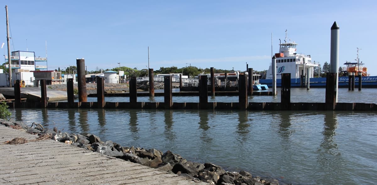
The public ramps at Toondah Harbour, Cleveland – two lanes and 49 bays beside the Straddie ferry terminal, toilets and water, no pontoon. Busy with ferry traffic, and the subject of a long-running redevelopment plan.
Mainland
Cleveland, Shore Street
A single lane at Cleveland Point, with toilets and water and eight bays, under the lighthouse at the end of Shore Street. Tide-limited across the flats, but a fine spot on the top of the tide.

Mainland
Cleveland, William Street
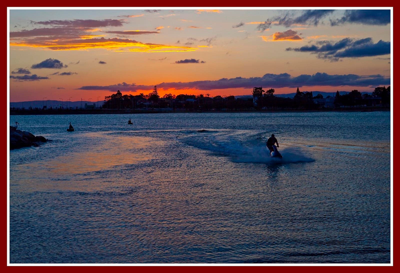
The William Street boat haven at Raby Bay – the largest recreational marine facility in the Redlands, with public ramps, a floating walkway, the Marine Rescue ramp and the boat club, 127 shared bays, and a channel dredged to two metres below low water.
Mainland
Clontarf, Pelican Park, Thomas Street
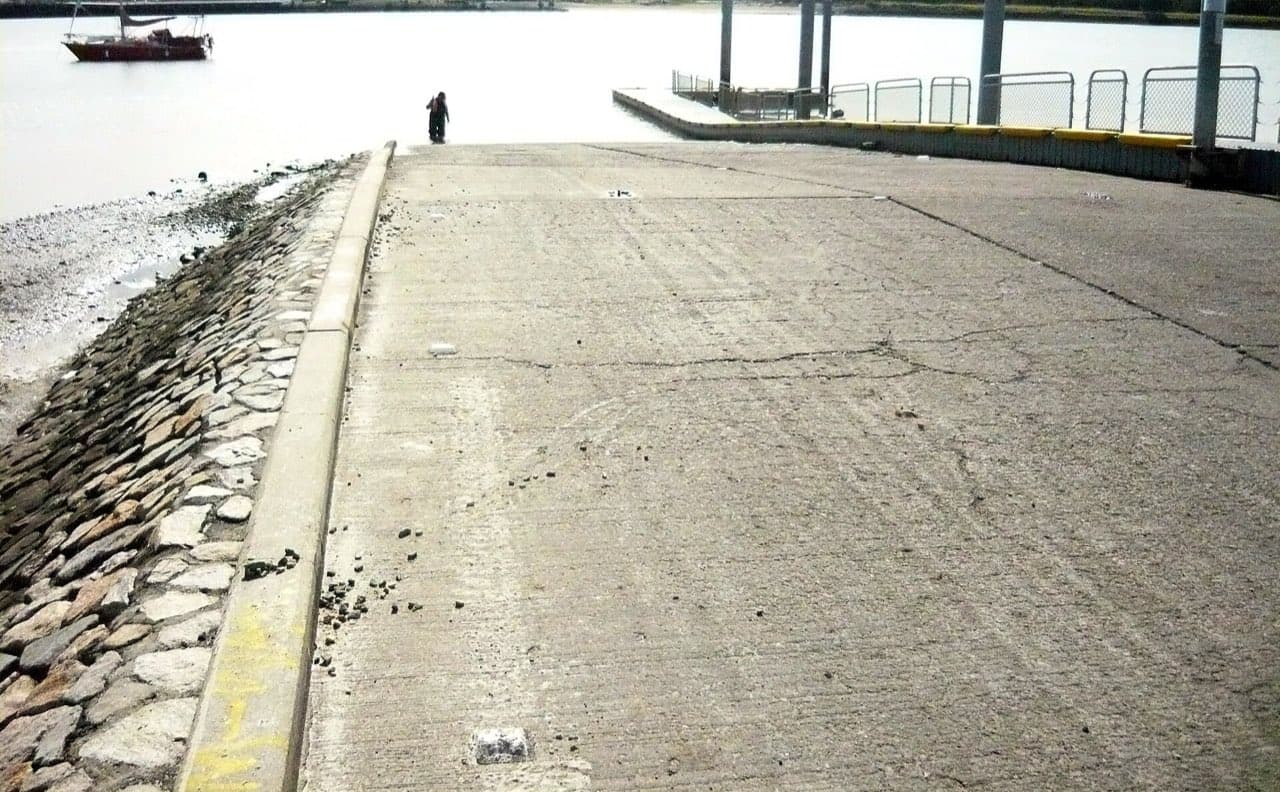
Pelican Park at Clontarf – four lanes with a floating walkway on the western side of the Redcliffe peninsula, toilets, water and 60 bays, beside the Hornibrook bridge. Sheltered from the south-easterly; flagged tide-limited over the Hays Inlet flats.
Mainland
Colmslie, Lytton Road
Colmslie Reserve on Lytton Road – two lanes with a pontoon and floating walkway on the south bank of the Brisbane River, a tap and 21 bays, and a fishing platform. The east-side river ramp.
Coochiemudlo Island
Coochiemudlo, Tageruba Street
Coochiemudlo's combined barge and boat ramp on the island's south side – a single lane with a pontoon, toilets and water, rebuilt by council in 2018 with guide pylons for the vehicle barge from Victoria Point.
Mainland
Coochin Creek, Roys Road
The Roys Road ramp on Coochin Creek – a single lane with 15 bays and no facilities at the end of a long road through the pine plantations, launching into the creek that feeds the middle Pumicestone Passage.
Mainland
Donnybrook, Grant Lane
The Grant Lane ramp at Donnybrook, opposite the caravan park – two lanes onto the upper Pumicestone Passage with toilets, water and 15 bays. A bit muddy at low tide, and the launch for the quiet northern end of the Passage.
North Stradbroke Island
Dunwich, Yabby Street
The One Mile boat haven at Dunwich – two lanes with a pontoon and jetty inside the small harbour, toilets and water, but only seven bays. The island's sheltered launch, a short run from the ferry terminal.
Mainland
Eagleby, Logan Boat Ramp Lane
Logan River Parklands at Eagleby – two lanes beside the Pacific Motorway bridge with 45 bays, on the tidal Logan below Beenleigh. No toilets, water or pontoon; flagged tide-limited by the state.
Mainland
Fig Tree Pocket, Fig Tree Pocket Road
A single lane on the north bank of the Brisbane River at Fig Tree Pocket – five bays, a tap, no toilets, in the quiet western reaches below the Mandalay bend. Small boats and kayaks.
Mainland
Golden Beach, Churchill Street
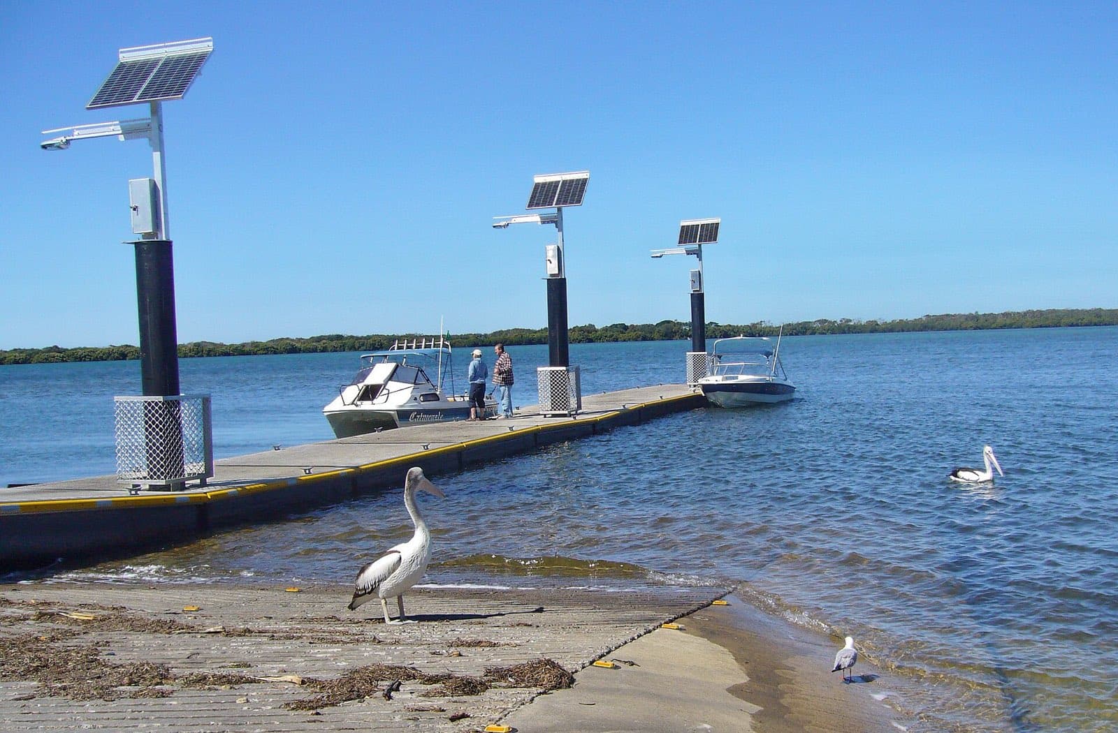
Woorim Park at Golden Beach – four lanes onto the Pumicestone Channel with toilets and water, but only 16 marked bays. The main Caloundra launch, used by the jet ski hire and the boat-licence school.
Mainland
Golden Beach, Short Street
The Short Street ramp at Leach Park, Golden Beach – two lanes onto the Passage with a tap and unmarked parking, tide-limited over the banks. The quieter of Golden Beach's ramps.
Mainland
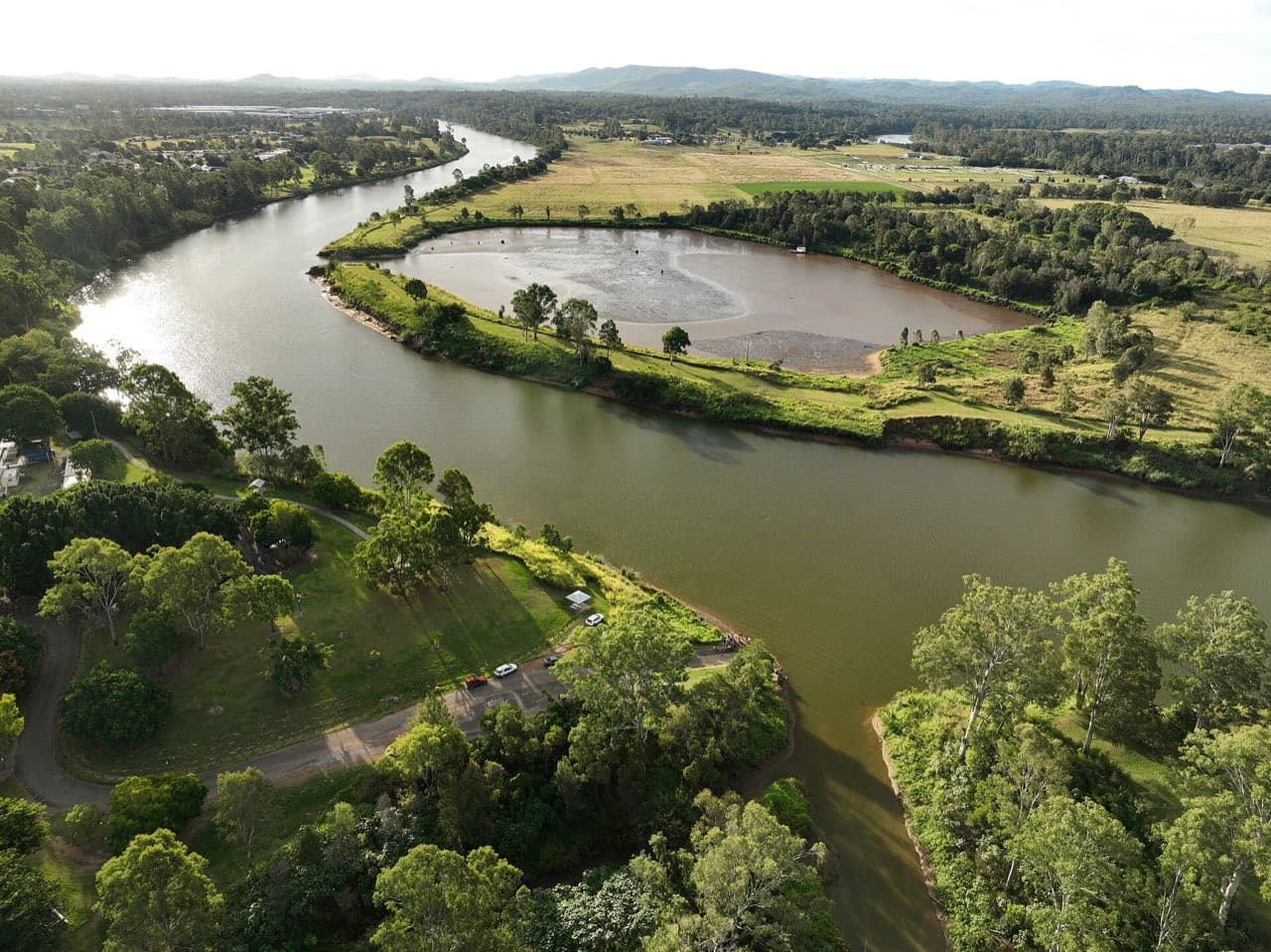
Goodna, Noel Kelly Drive
Richardson Park at Goodna – a single lane on the south bank of the Brisbane River with on-road parking for about four and no facilities. The lowest of the Ipswich ramps, on a quiet reach above the Moggill ferry.
Mainland
Griffin, Dohles Rocks Road
Dohles Rocks at Griffin – two lanes with a floating walkway on the north bank of the Pine River, toilets and 23 bays, in a riverside reserve popular for fishing and picnics. Room for two trailers on the ramp at a time.
Mainland
Hemmant, Aquarium Passage
The Aquarium Passage ramp at Hemmant – a single lane with a pontoon on Bulimba Creek where it joins the Brisbane River, five bays, no facilities. A small east-side launch for the lower river.
Mainland
Hilliards Creek, Bligh St
A small council ramp on Hilliards Creek at Bligh Street, Wellington Point – a single lane into a mangrove creek with no facilities and no state data beyond its existence. Tinnies and kayaks on the top of the tide.
Mainland
Indooroopilly, Meiers Road
Sir John Chandler Park at Long Pocket, Indooroopilly – a single lane with a pontoon on the north bank of the Brisbane River, toilets and water, unmarked parking. One of council's river hubs, flagged tide-limited.

Mainland
Jacobs Well, Pimpama Jacobs Well Road
Jacobs Well – four 4-metre lanes with a floating walkway, a relocated pontoon and a new jetty at Lions Park since the 2021 upgrade, toilets, water, a bait shop and 105 bays. The best ramp in the southern bay, and it still fills.
Mainland
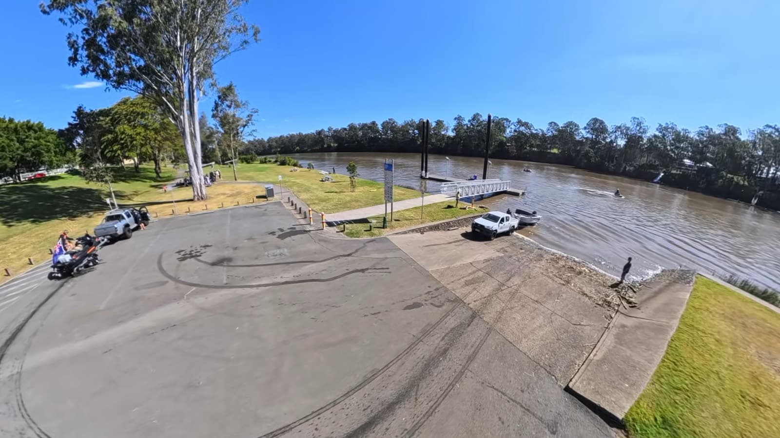
Jindalee, Noolinga Street
Located along Brisbane River's western reaches – perfect for fishing and peaceful river cruising.
Mainland
Karalee, Park Road
The Park Road ramp at Karalee, on the south side of the Brisbane River at Barellan Point – a single lane with six bays and a water tap, on the quiet upper river near the Bremer junction.
Mainland
Karana Downs, Caringal Drive
Kookaburra Park at Karana Downs – a single lane on the north bank of the Brisbane River with 15 bays and no facilities, the highest trailer-boat ramp on the tidal river now that Colleges Crossing is a kayak put-in.
Southern Moreton Bay Islands
Karragarra Island, The Esplanade
Karragarra's single ramp with a pontoon on the island's north-west side, beside the swimming enclosure and the best white-sand beach of the four islands. Tide-limited, informal parking, no toilets at the ramp.
Mainland
Kings Beach, Margaret Street
A single ramp at Margaret Street, Kings Beach – four bays, a tap, and the Caloundra bar and headland at the door. A small-boat ramp on the ocean side of town, tide-limited.
Southern Moreton Bay Islands
Lamb Island, Lucas Drive
Lamb Island's combined barge and boat ramp on Lucas Drive – a single lane with a pontoon, toilets and water on the island's south-west side. Tide-limited, and shared with the vehicle barge.
Mainland
Logan Reserve, Henderson Road
Henderson Park at Logan Reserve – a single lane on the upper Logan with unmarked parking and no facilities, flagged tide-limited. The highest public ramp on the river, for tinnies and kayaks.
Mainland
Lota. Cobar Street
The Lota ramp on the Esplanade – a single lane onto the Waterloo Bay flats between Manly and Wynnum Creek, unmarked parking and no facilities. Dries out on the low; a top-of-the-tide launch for small boats.
Southern Moreton Bay Islands
Macleay Island, Dalpura Street
The Dalpura Bay ramp at the northern end of Macleay Island – a single lane with ten bays, toilets and water, and no pontoon. Tide-limited across the flats; the island's other ramp at Russell Terrace has the walkway.
Southern Moreton Bay Islands
Macleay Island, Russell Terrace
Macleay Island's main ramp beside the ferry terminal on the south side – two lanes with a pontoon and floating walkway, toilets and water, and all-tide access. Watch the ferries and the barge.
Mainland
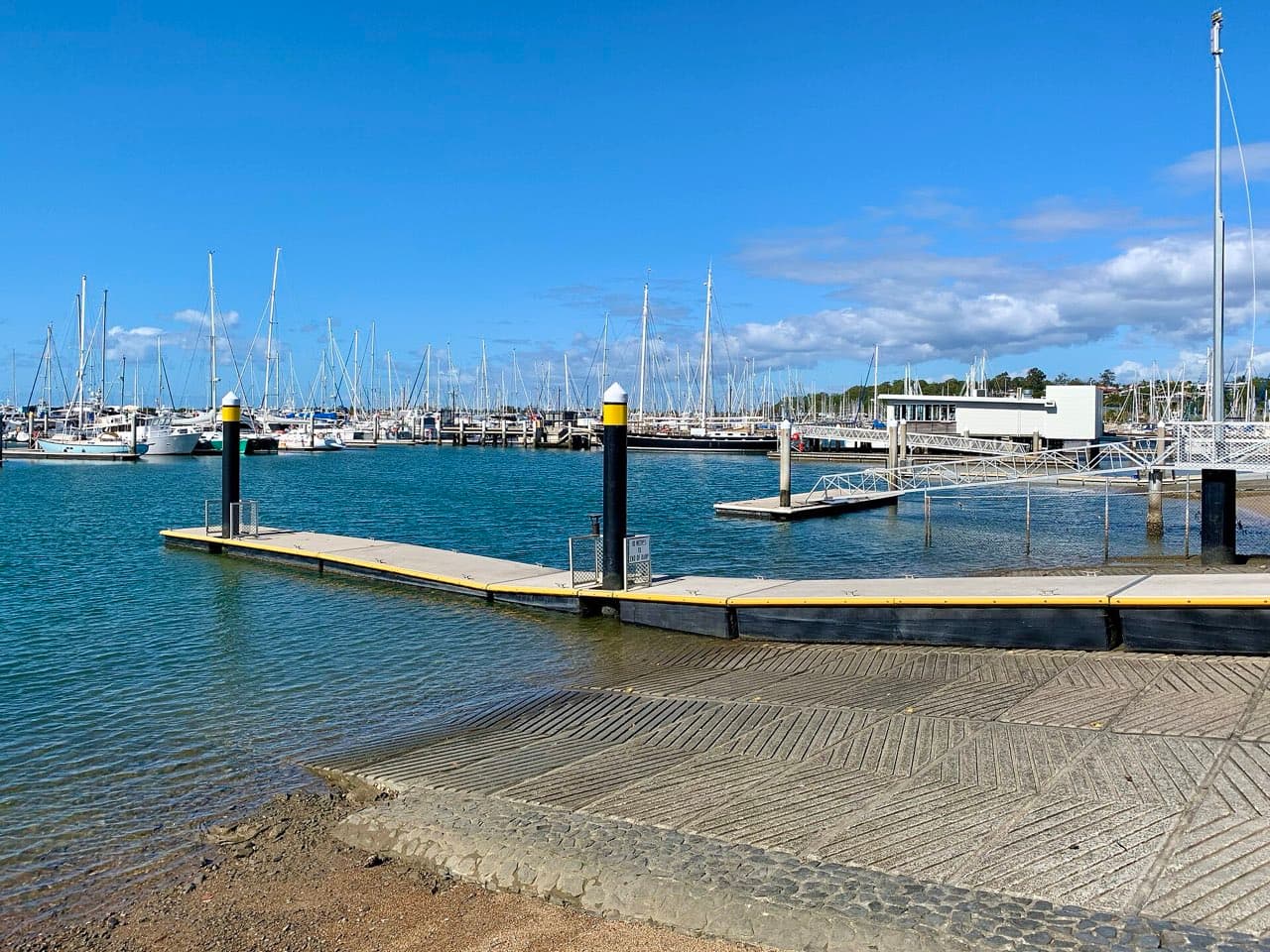
Manly Boat Harbour, Fairlead Crescent
The northern ramp in Manly State Boat Harbour – four lanes with a floating walkway inside the breakwaters on Fairlead Crescent, 112 secure bays, water, and the Coast Guard next door. All-tide, sheltered, and the busiest launch on Brisbane's bayside.

Mainland
Manly Boat Harbour, South
The southern ramp in Manly State Boat Harbour – three lanes with a floating walkway, toilets, water and 115 bays at the harbour's southern end. The quieter of Manly's two all-tide ramps.
Mainland
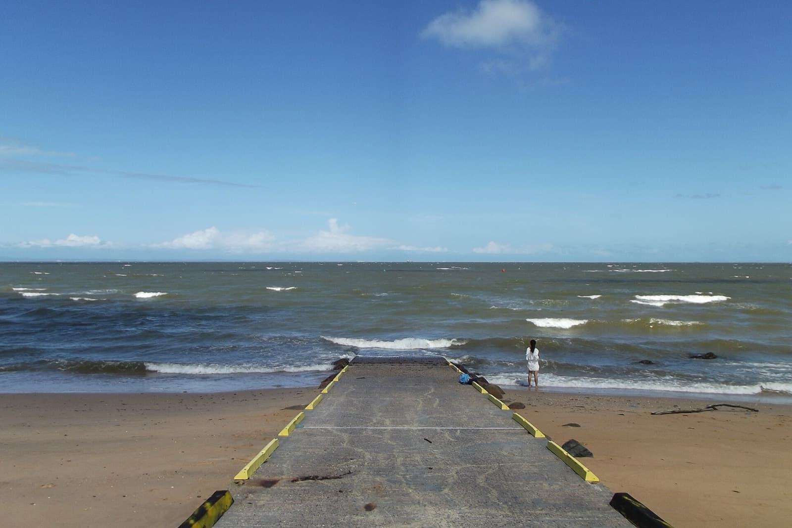
Margate, Eveline Street
The Margate beach ramp on the eastern side of the Redcliffe peninsula – a single lane onto Margate Beach with toilets and water and six bays. Open to the easterly, small boats only.
Mainland
Meldale, Way Street
The Way Street ramp at Meldale on Elimbah Creek – two lanes with toilets and water and unmarked parking, in a tiny rural locality on the creek that feeds the southern Pumicestone Passage.
Mainland
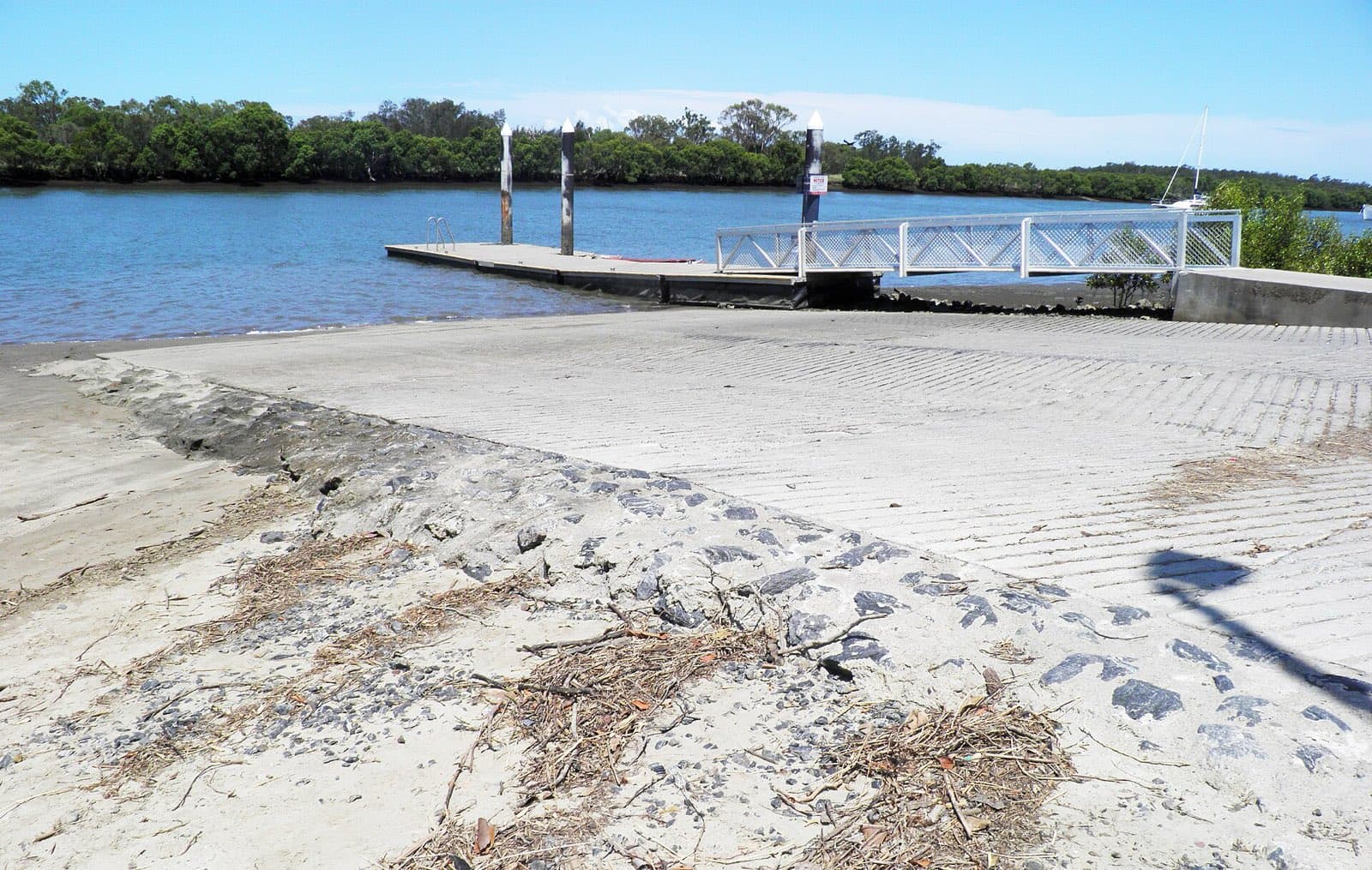
Nudgee Beach, Nudgee Road
Tuckeroo Park at Nudgee Beach – four lanes with pontoons and a floating walkway on the Kedron Brook Floodway, toilets, water and 46 bays. Brisbane's northern bay ramp, widened in 2016; the floodway is shallow on a low.
Mainland
Pelican Waters, June Street
The Bells Creek ramp at Jensen Park, June Street – three lanes onto the northern Pumicestone Passage at the Golden Beach and Pelican Waters boundary, toilets, water and 25 bays, with sandy beach either side and yabby banks beside it.
Mainland
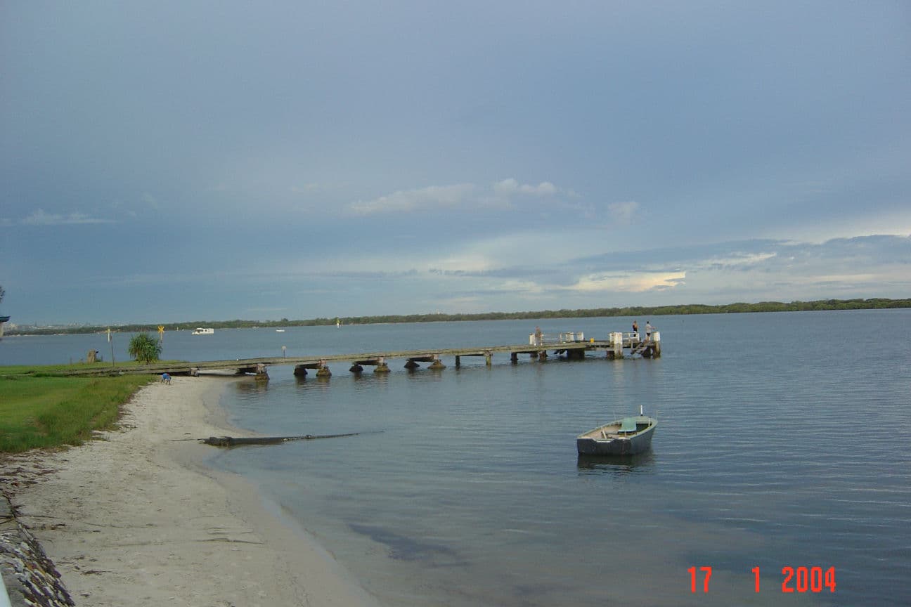
Pelican Waters, Raleigh Street
The Military Jetty ramp at Raleigh Street, Pelican Waters – a single lane with a pontoon at the end of Keith Hill Park, toilets, water and eight bays. Very open to the weather, and with a three-tonne limit.
Mainland
Pinkenba, Kirra Street
The Kirra Street ramp at Pinkenba – a plain concrete ramp into deep water on the north bank of the lower Brisbane River, in the industrial estate off Tingira Street, with 26 bays and no facilities. The closest launch to the river mouth.
Mainland
Port of Brisbane, Port Drive
The Whyte Island ramp on Port Drive – four lanes on the Boat Passage at the Port of Brisbane, with lighting, toilets, a picnic area and 30 bays. Closed for reconstruction and a new floating walkway from July to about October 2026.
Mainland
Redland Bay, Banana Street
Weinam Creek at Redland Bay – the commuter ramp for the Southern Moreton Bay Islands. Since November 2024 the public launches from a new three-bay ramp with a pontoon and 40 trailer bays linked to the Moores Road car park; the old four-lane Banana Street ramp is now reserved for emergency services.
Mainland
Redland Bay, Moores Road
The small Moores Road ramp off the Esplanade at Redland Bay – a single lane with toilets and water and five bays, tide-limited across the flats. The Moores Road car park now also serves the new Weinam Creek ramp next door.
Southern Moreton Bay Islands
Russell Island, Alice Street (Jock Kennedy Park)
The Jock Kennedy Park ramp on the western side of Russell Island – two lanes with a pontoon, 12 bays and barbecues in the park, on water that locals say is usable almost all the time. No toilets or tap at the ramp.
Southern Moreton Bay Islands
Russell Island, Wahine Drive
The Wahine Drive ramp on the eastern side of Russell Island – two lanes onto the Canaipa Passage, with ample informal parking and no facilities. The launch for the back of Straddie and the run south to Jumpinpin.
Mainland
Sandstone Point, Kal Ma kuta Drive
The Kal Ma Kuta Drive ramp at Sandstone Point – two lanes onto the Pumicestone Passage just north of Spinnaker Sound Marina, toilets, water and 43 bays, with the Bribie bridge alongside. Watch the old oyster lease off the hotel.
Mainland
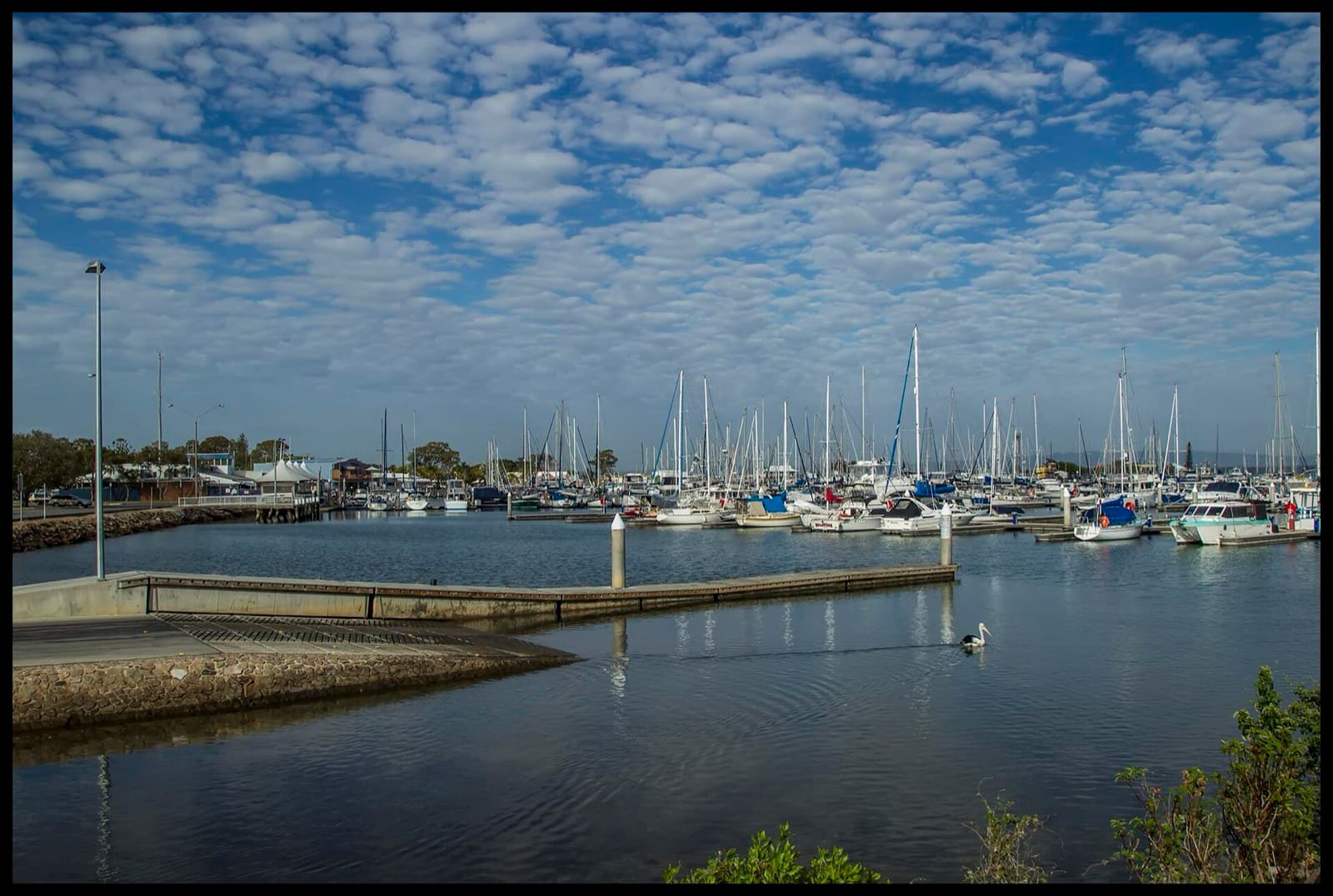
Scarborough, Bird O'Passage Parade
The eastern ramp in Scarborough Boat Harbour – four lanes with a floating walkway inside the state harbour at Bird O'Passage Parade, toilets, water and 76 bays. All-tide, sheltered, and the peninsula's launch for Moreton Island.
Mainland
Scarborough, Flinders Parade
The Queens Beach North ramp on Flinders Parade, Scarborough – a single beach lane opposite Griffith Road with toilets, water and six bays. Tide-limited and open to the east; the harbour ramps are five minutes away.

Mainland
Scarborough, Thurecht Parade
The western ramp in Scarborough Boat Harbour on Thurecht Parade – three lanes with a floating walkway, lighting, toilets, water and the harbour's biggest car park at 120 bays. All-tide inside the breakwaters.
Mainland
Shorncliffe, Jetty Street
The Jetty Street ramp on Cabbage Tree Creek at Shorncliffe – two lanes with a pontoon, toilets and water, but only six bays, upstream of the big Sinbad Street harbour ramp. The small-boat option on the creek.
Mainland
Shorncliffe, Sinbad Street
The Cabbage Tree Creek Boat Harbour ramp at Sinbad Street, Shorncliffe – four wide lanes with a central pontoon inside the sheltered creek, fish cleaning, water and about 170 bays. The northside's biggest ramp.
Mainland
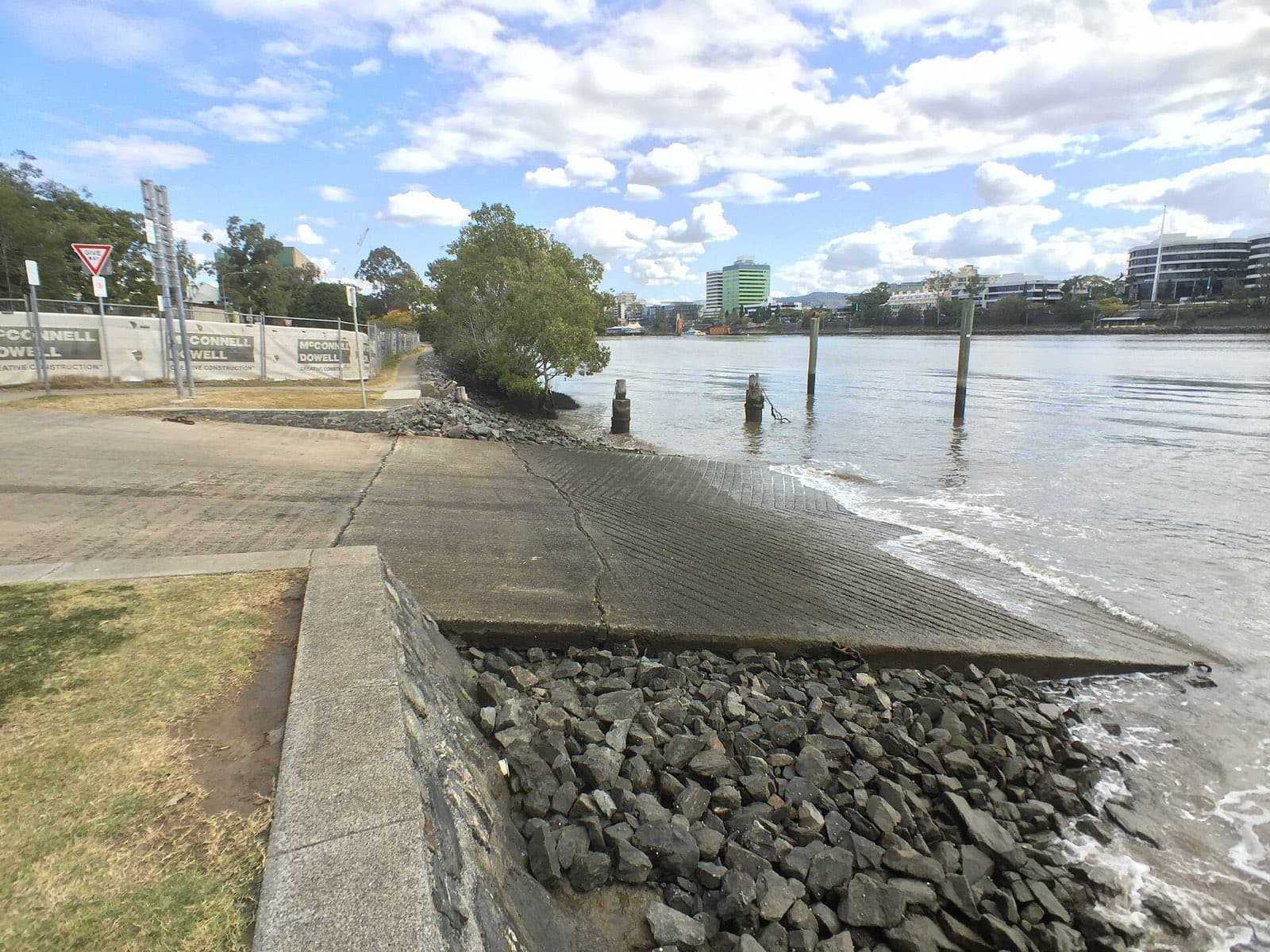
South Brisbane, Riverside Drive
The Riverside Drive ramp at South Brisbane Riverside Lands Park – a double ramp with a pontoon on the south bank under the William Jolly Bridge, 15 bays, no facilities. The city-centre launch, with all the traffic that implies.
Mainland
Steiglitz, Cabbage Tree Point Road
Cabbage Tree Point at Steiglitz – three lanes at Charlie Hammel Park with toilets, a sandy beach, barbecues and a playground, and 18 bays plus the street. The launch for the southern bay islands, and a very busy one.
Mainland
Strathpine, Learmonth Street
The Learmonth Street ramp at Strathpine – a single lane into the South Pine River at Bob Bell Park behind the shopping centre, five bays and toilets. A quiet upriver launch for tinnies and kayaks.
Mainland
Tanah Merah, Tansey Drive
Tansey Park at Tanah Merah – a single lane on the north bank of the Logan with seven bays and no facilities, between Waterford and Carbrook. A quiet small-boat ramp on sheltered river.
Mainland
Thorneside, Helen Street
The Helen Street ramp at Thorneside – a single lane into Tingalpa Creek on Queens Esplanade, with toilets, water and 11 bays. Sheltered creek water, a short run to the bay past the Aquatic Paradise canals.
Mainland
Toorbul, First Avenue
The First Avenue ramp on the Toorbul Esplanade – a single lane onto the Pumicestone Passage, toilets and water, sharing 34 bays with the Freeman Road ramp. Tide-limited across the Toorbul flats.
Mainland
Toorbul, Freeman Road
Toorbul's main ramp near Freeman Road – two lanes with the floating walkway the state built in 2015, toilets, water and 34 shared bays on the Esplanade. All-tide in the register, with the Passage flats to cross.
Mainland
Toorbul, Moffat Esplanade
The Moffat Esplanade ramp on Ningi Creek, south of Toorbul – a single lane with toilets, water and lighting, unmarked parking, and low-tide restricted access up the creek.
Mainland
Victoria Point, Colburn Avenue ( North )
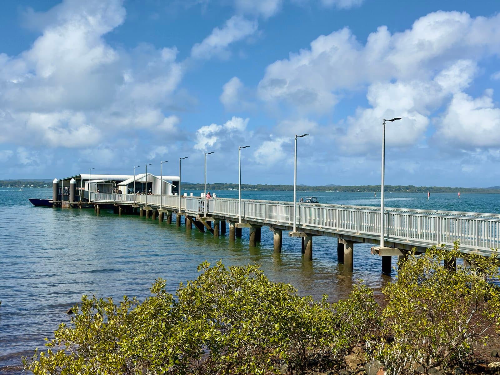
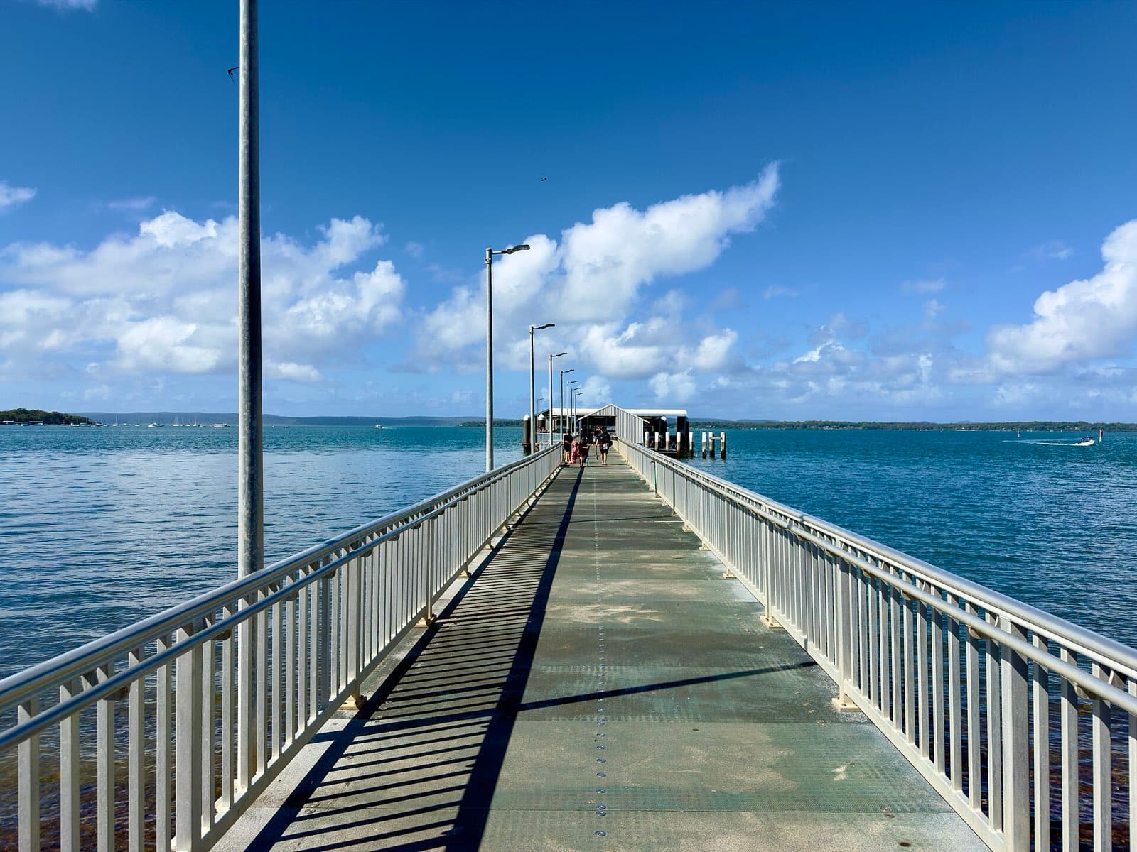
The Colburn Avenue ramp on the northern side of the Victoria Point reserve – two lanes with a floating pontoon, toilets, water and 56 bays, and the passenger ferry to Coochiemudlo alongside. The pontoon is due for full replacement.
Mainland
Victoria Point, Masters Avenue
The combined barge and boat ramp in the Masters Avenue harbour at Victoria Point – two lanes with a pontoon and toilets, 15 bays, and the Coochiemudlo vehicle barge sharing the water.
Mainland
Waterford, Albert Street
Larry Storey Park at Waterford – a single lane on the south bank of the Logan with toilets and seven bays, below the old Waterford bridge. A pleasant upriver ramp for small boats.

Mainland
Wellington Point, Main Road
Wellington Point's Main Road ramps – four lanes with a pontoon and jetty on the foreshore, toilets, water and 70 bays, and one of the most popular launches on the bay. Also one of the worst at low tide: the flats dry a long way out.
Mainland
Woody Point, Hornibrook Esplanade
The Woody Point ramp at the end of Oxley Avenue near the sailing club – three lanes onto Bramble Bay with toilets, water, lighting and a picnic area, but only 13 bays and a three-tonne limit. Accessible on the upper tide.
Mainland
Wyaralong Dam
The Lake Wyaralong ramp at the Meebun day-use area – electric, sail and paddle craft only on Seqwater's newest dam, with toilets, picnic shelters and five bays. Bring your own drinking water.
Mainland
Wynnum, Glenora Street
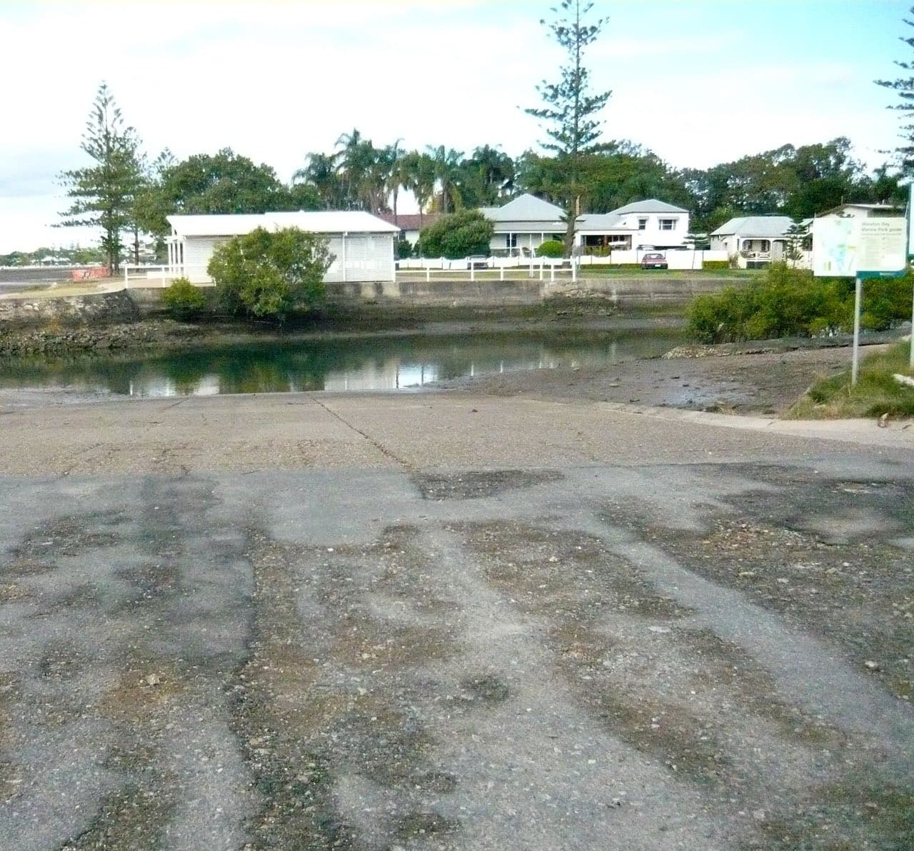
The Glenora Street ramp on Wynnum Creek – two lanes into a sheltered creek with good depth, toilets and water, and plenty of parking. Locals' pick for Mud Island and St Helena without the Manly queues.
Mainland
Yatala, Patterson Road
A single council ramp on the Albert River at Patterson Road, Yatala – no facilities, ten parks, and a reputation as the worst-rated ramp on the Gold Coast list. Don't trust the map app: it sends you to the wrong bank.
Gateways
2Peel Island
Peel Island
Fifteen minutes east of Raby Bay and the water turns that impossible turquoise Horseshoe Bay is famous for. Peel is the closest thing Moreton Bay has to a proper island day trip: anchor in the shallows, swim, fish, and let the afternoon go nowhere. Just watch the tide, because the sand shelf runs 250 metres off the beach and it does not care how good your day was going.
Moreton Island
Tangalooma
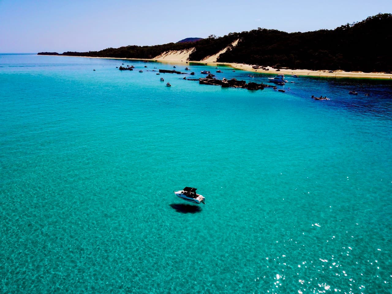
An hour or two northeast across Moreton Bay, past the shipping lanes, and the rusted spines of fifteen scuttled ships come up out of the water. Behind them is calm anchorage, coral, dolphins at sunset and 98% national park at your back. Tangalooma is the day trip every Brisbane boatie should have done at least once.
Camping
7North Stradbroke Island
Amity Point Camping Area
Minjerribah Camping is the camping operator for North Stradbroke Island, run under the Quandamooka traditional owners. They offer beachfront camping across six campgrounds spread over the island's three townships: Dunwich, Amity Point and Point Lookout, including Adder Rock, Cylinder Beach, Home Beach, Main Beach, Bradbury's Beach and Adam's Beach. If you've got a 4WD there's a lot more on offer: around 200 campsites along the Flinders Beach foreshore and another 300 at the southern end of Main Beach, both of which need a 4WD vehicle access permit. For anyone who doesn't want to pitch a tent, glamping setups are available at Cylinder Beach, Adder Rock, Amity Point and Bradbury's Beach. The site also runs a beach conditions report worth checking before you drive on, and there's a standing safety warning about aluminium phosphide rat-poison canisters washing ashore — they're toxic, shouldn't be touched or opened, and sightings go to 000. It's about a 45-minute drive from Brisbane to Cleveland plus the vehicle ferry across, so it's an easy weekend run.
North Stradbroke Island
Blaksley Camping Area
Escape the crowds at this secluded camping area in Naree Budjong Djara National Park. With great views over the bay islands and Moreton Bay Marine Park, and only accessible by watercraft.
Moreton Island
Comboyuro Point Camping Area
Comboyuro Point is a large, shady campground on the western side of Mulgumpin (Moreton Island), within walking distance of Bulwer township, and it's one of the more sheltered options on the island since it sits on the calm bay side rather than the surf coast. There are 49 sites, all marked with totems and varying in size, and the surface is sand — so bring sand pegs. It suits tent camping beside the car, walk-in camping, camper trailers and large groups, with parking right beside the sites. Facilities are reasonable by island standards: water (needs treating before drinking), septic toilets, cold showers, rubbish bins and a portable toilet waste dump point. Open fires are allowed in existing fire rings when bans aren't in force, though gas stoves are recommended and you'd need to bring untreated firewood in; generators aren't permitted. Access is by 4WD or on foot, mobile coverage is poor and unreliable, and bookings open a maximum of six months ahead. Note this one is run by QYAC and not the same operator as the Straddie campgrounds — separate booking system and separate 4WD permit.
Bribie Island
Gallagher Point Camping Area
Gallagher Point is a small, low-key bush camping area on the western side of Bribie Island, about 65km north of Brisbane, sitting on the shores of Pumicestone Passage with views across to the Glass House Mountains and Toorbul. It's genuinely tiny — just 6 numbered sites, max six people each, on a mix of sand, dirt and grass, 2km north of White Patch. Facilities are nil, so you bring everything: drinking and cooking water, gas stove (or untreated mill off-cut firewood), rubbish bags, insect repellent, and ideally a portable toilet since there are none provided. Fires are allowed in the provided rings outside of bans, generators aren't permitted, and mobile coverage is poor. Access is high-clearance 4WD with low range only — no 2WD, trail bikes or motorbikes are even allowed a permit for the recreation area — via the bridge, north along Sunderland Drive and White Patch Esplanade, then 180m down the Poverty Creek access track and 3km in on the camping area track at 30km/h. You can also arrive by boat or kayak, though there are no launching or recovery facilities. The catch worth knowing: sites are sometimes closed to bookings due to flooding on very high tides, and there's a standing park alert about tidal inundation restrictions running to December 2026 — so check alerts and tides before you commit. You need both a camping booking and a separate vehicle access permit, with number plate recognition cameras in use. Good spot for sheltered paddling, swimming, and fishing for bream, flathead, whiting, tailor and mangrove jack.
Bribie Island
Mission Point Camping Area
Bribie Island
Poverty Creek Camping Area
Moreton Island
The Wrecks camping area, Gheebulum Kunungai (Moreton Island) National Park
The Wrecks camping area sits beside a sheltered bay on Mulgumpin (Moreton Island), near the main barge landing for Moreton Island Ferries, which makes it one of the more accessible options on the island and the standout choice if you're arriving by boat or without a vehicle. There's a maximum of 21 totem-marked sand sites, though seasonal closures mean not all are open year-round. Importantly it's walk-in camping only: you park on the beach and carry gear a short distance to your site, and it isn't suitable for camper trailers. Facilities are decent for a national park campground, with water (treat before drinking), hybrid toilets, cold showers and rubbish bins, plus, unusually, a QldParks-Wifi hotspot. That last one matters because mobile coverage across the island is poor and unreliable, with better reception only near Tangalooma. Open fires are prohibited here, unlike Comboyuro, and generators aren't allowed either. It's a natural base for snorkelling and diving on the Tangalooma wrecks themselves, plus kayaking, swimming and fishing in the protected water. Bookings go through Mulgumpin Camping (QYAC), same as Comboyuro. Two current things to check: a park alert closing the Middle Road to Cowan township high tide access track through to 30 September 2026, and the Mulgumpin conditions report, updated 1 September.
Diving
4North Stradbroke Island
Flat Rock – Shark Alley
Shark Alley - Famous for grey nurse sharks in season; dramatic gutters and bommies. Cherubs Cave - Swim‑through and cave features; advanced conditions and surge possible. Gotham City - Steep walls with large schools and visiting. The Nursery - Sheltered side with schooling fish and soft corals; suitable for intermediate divers.
Moreton Island
Flinders Reef
Diving spots: Coral Gradens, Turtle Cleaning Station, and the Aarhus Wreck (near Flinders Reef).
North Stradbroke Island
Shag Rock – East and West
Sheltered reefs with turtles and wobbegongs; good for newer divers. Fringing reef and bommies; easy navigation and plentiful life.
Moreton Island
Tangalooma Wrecks
Iconic line of scuttled wrecks with abundant fish life; great for snorkelling on a calm westerly.

History
12Moreton Island
Aarhus (1894)
A Danish iron barque, 122 days out of New York with 15,760 cases of kerosene, struck Smith Rock off Cape Moreton on a February night in 1894 and sank in ten minutes. All fifteen aboard reached shore. The Marine Board blamed her captain, then turned on the pilot service that had left him waiting an hour for a pilot who never came.
Bribie Island
Bribie Island WWII Bunkers
Northern Bribie Island was fortified during the Second World War as part of the ring of positions watching the approaches to Moreton Bay. Bunkers, gun emplacements and observation posts were poured quickly and low, with narrow openings and siting chosen for lines of sight rather than comfort. They were never built to last. Sand, wind and salt have half-buried most of them, and some are visible only as angular concrete breaking through the dune contours. There is no central complex and no signage. Several are unstable or partially collapsed, and shifting sand can undercut edges without warning.
Moreton Island
Fort Cowan Cowan
A World War II coastal defence position on the western shore of Moreton Island, built as part of the ring of batteries guarding the approaches to Brisbane. Gun emplacements, magazines and observation structures remain among the dunes. The site is unrestored and exposed. Concrete edges and open shafts are a real hazard, so stay on formed tracks.
Peel Island
Peel Island Lazaret
Peel Island held Queensland's leprosarium for just over half a century. Patients were housed in separate compounds and the settlement operated as a closed community until it closed in 1959. Timber huts, the recreation hall and remnants of the water and drainage systems survive, and the site is one of the most intact of its kind in Australia. The lazaret area is protected and access is restricted. Check current conditions of entry before planning a landing.

Peel Island
Platypus (1926)
A Clyde-built bucket dredger that spent forty-two years cutting channels from Brisbane to the Gulf, opening much of Queensland's northern port trade. She was decommissioned in December 1923 and deliberately sunk off Peel Island in October 1926 to shelter the lazaret jetty.

North Stradbroke Island
Princeza (1863)
An Aberdeen-built brigantine driven onto the South Passage bar off Amity Point in a March gale in 1863. Her crew hove the cargo overboard and cut away the masts trying to lighten her; three days later the hull was sold where she lay for one hundred and sixty pounds.

Moreton Island
Sovereign (1847)
The paddle steamer Sovereign broke up on the South Passage bar in March 1847 with fifty-four people aboard. Forty-four drowned, in what remains the worst shipwreck of colonial Queensland, and the ten who lived were pulled from the surf by Quandamooka men who swam out to them. The loss closed the South Passage to shipping.
St Helena Island
St Helena Island Penal Establishment
St Helena operated as Queensland's high-security prison for sixty-five years, largely self-sufficient behind its own farms, sugar mill and tramway. Stone and brick ruins of the stockade, mess and superintendent's quarters remain, along with the cemetery. The island is a national park and landing is permitted only with a licensed tour operator.

Moreton Island
St Paul (1914)
A French steamer out of New Caledonia carrying 2,371 tons of chrome ore struck an uncharted pinnacle east of Smith Rock within minutes of midnight on 26 March 1914, while steering towards the pilot boat. She went down bow-first in about five minutes and no boat was ever got into the water. Eighteen of the twenty-nine aboard died, the master among them. This is the only surveyed position published for any wreck on this rock. It was derived by GPS and lies about 1.2 km east of the gazetted position of Smith Rock, which fits the 1914 evidence that she struck a pinnacle east of the rock itself.
Moreton Island
Tangalooma Wrecks
Fifteen vessels were deliberately sunk here off the western side of Moreton Island to form a sheltered anchorage for small craft. The hulks now sit in shallow water close to the beach and have become one of the most visited snorkelling and dive sites in the bay, with the wrecks acting as an artificial reef. Access is by boat. The wrecks are close together and the surrounding water is shallow, so keep well clear of the hulls under power.
Bribie Island
Woorim Beach WWII bunker
Woorim Beach WWII bunker

Moreton Island
Young Australia (1872)
An American extreme clipper, built at Portsmouth, New Hampshire in 1852 as the Red Rover and renamed when the Black Ball Line bought her in 1861, she carried thousands of immigrants to Moreton Bay on some of the fastest runs ever made from England. On 31 May 1872, homeward bound for London with 812 bales of wool, the breeze died on her four and a half hours out of the anchorage. A heavy easterly swell laid her broadside on the rocks at North Point in fine weather and broad daylight. All thirty-one passengers and the crew were landed on the beach, most of the cargo was salvaged, and a small cannon off her deck is still in Brisbane. What survives lies in three to six metres of water in the surf zone and is progressively covered by sand.